


 China set to lead further growth of UKHO’s Port Approach Guide portfolio
The United Kingdom Hydrographic Office (UKHO) continues to expand its Port Approach Guide portfolio, with coverage in Asia set to expand significantly through the inclusion of ports in China. This will be a significant step towards the UKHO’s goal of providing Port Approach Guide coverage of the world’s busiest ports.
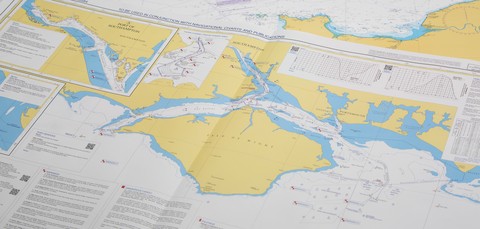
The UKHO’s Port Approach Guides are port-scale charts that contain a wide range of planning and support information for some of the world’s busiest ports. By providing bridge crews this information in one place, each guide can simplify a number of passage planning tasks; making port entry and exit quicker and easier. Taken from official ADMIRALTY charts and publications, this planning information usually includes Vessel Traffic Service Information (VTS), Principal lights and landmarks, tidal information, pilotage, port regulations and other port specific warnings.
Each Port Approach Guide can also be used to understand any changes to a port area, with Quick Response (QR) codes providing quick links to relevant updates on ADMIRALTY EasyTide and Notice to Mariners WebSearch. Preliminary Notice to Mariners are also included in Section II of paper NMs. International Code of Signals (ICS) flags are also used as a way of drawing attention to features, helping mariners to quickly link chart features to the associated text panels. When used in conjunction with official navigational charts, this information can enhance situational awareness when making the port approach.
Nick Dekkers, UKHO Product Manager – Charts at the UKHO commented:
“The UKHO’s goal is to save mariners time during passage planning and Master Pilot Exchange (MPX). There is a clear requirement for passage planning assistance at the world’s busiest ports, giving bridge crews clarity and reassurance during times of peak workload and pressure. We have published over 90 Port Approach Guides, and the feedback from mariners, pilots and port authorities has been very positive.”
“We have been able to take advantage of our cartographic expertise and strong relationships with our partners around the world to cover hundreds of the world’s busiest ports. Given the growth enjoyed by many leading Asian ports, this will include a significant increase in Port Approach Guide coverage in Asia, including coverage of a number of Chinese ports later this year.”
Further details of the UKHO’s full range of Port Approach Guides can be obtained from: http://www.admiralty.
About the United Kingdom Hydrographic Office
- UKHO produces a worldwide series of some 3, 500 paper nautical charts, 200 publications under the ADMIRALTY Nautical Products & Services brand and Electronic Navigational Charts (ENCs). The ADMIRALTY Nautical Products & Services portfolio is sold globally and used by over 90% of the ships trading internationally.
- UKHO, an Executive Agency of the Ministry of Defence, has been charting the world’s oceans for more than 200 years with the primary aim of providing navigational products and services for the Royal Navy and merchant mariners to save and protect lives at sea. In addition it serves small craft and leisure mariners and provides a range of consultancy services.
- UKHO also plays a central role, in support of the Maritime and Coastguard Agency, in discharging the navigation element of the UK’s Safety of Life at Sea Treaty obligations for waters of UK national responsibility.