


Initiative aims to increase the global coverage, quality, and accessibility of seabed mapping data through collaboration and the creation of a more integrated marine geospatial sector Initiative aims to increase…
Initiative aims to increase the global coverage, quality, and accessibility of seabed mapping data through collaboration and the creation of a more integrated marine geospatial sector Initiative aims to increase…
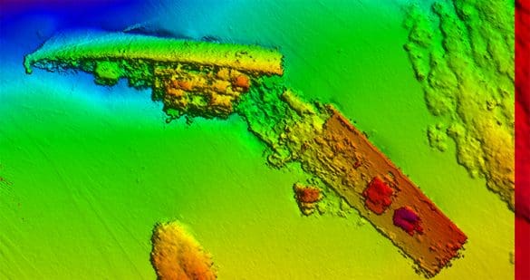
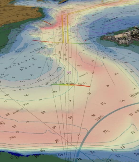
UK Government supports maritime trade and economic growth in the Cayman Islands UK Hydrographic Office to conduct seabed mapping surveys in the Cayman Islands, underpinning the region’s sustainable marine economy…