


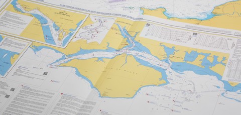
The United Kingdom Hydrographic Office (UKHO) today disclosed details of a new Electronic Navigational Chart (ENC) which could help to improve situational awareness and safety. Developed to cover an area…

The United Kingdom Hydrographic Office (UKHO) today disclosed details of a new Electronic Navigational Chart (ENC) which could help to improve situational awareness and safety. Developed to cover an area…
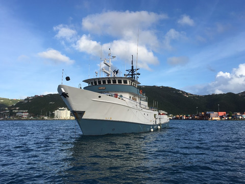
05 February 2018 – The United Kingdom Hydrographic Office (UKHO) has chartered two boats to survey the waters around the British Virgin Islands as part of the UK’s Overseas Territories Seabed…
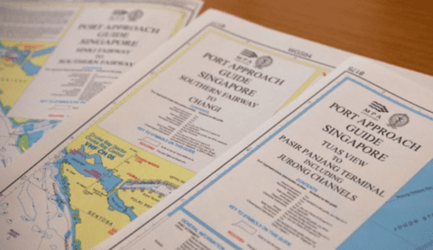
New charts designed to make port entry and exit quicker and easier The United Kingdom Hydrographic Office (UKHO) has launched three new Port Approach Guides with the support of the…

18 May 2016 – The United Kingdom Hydrographic Office (UKHO) has today reiterated its call for ship owners to upgrade to the latest ECDIS software standards, highlighting the significant benefits that…
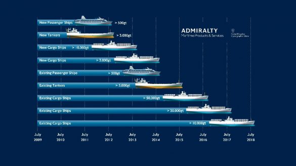
Six free seminars over three days for shipowners implementing ECDIS and those already living with ECDIS 11 May 2016 – The United Kingdom Hydrographic Office (UKHO) has announced the details of…

Bursary recipients from South East Asia, Australasia, Hong Kong and Pacific Island Community to attend five-week course in producing navigational charts April 18, 2016 – The United Kingdom Hydrographic Office (UKHO) and…

April 1, 2016 – The United Kingdom Hydrographic Office (UKHO) has observed an increase in the number of counterfeit versions of ADMIRALTY charts and publications in circulation and is re-issuing a warning…
China set to lead further growth of UKHO’s Port Approach Guide portfolio The United Kingdom Hydrographic Office (UKHO) continues to expand its Port Approach Guide portfolio, with coverage in Asia…