



As President of SEA GUARDIAN SG LTD, I have the pleasure to introduce to the International Maritime Community the in-house developed DACOR system, a web-based tool that improves the fast understanding of the maritime situational awareness for shipping, thus contributing to the maritime security of Seafarers, the environment, vessels and cargoes.
SEA GUARDIAN has taken steps to improve the decision-making process of its Shipping Partners and Armed Security Teams aboard vessels sailing through high-risk areas, among other things. SEA GUARDIAN has developed a web-based Data, Control, and Reporting System, code name DACOR, to better visualize and present its weekly and monthly maritime situational awareness reports, as well as provide assessment and improved situational awareness.
The system’s programming code is under continuous re-evaluation by the SEA GUARDIAN IT developers to keep it constantly aligned with current and future demands and challenges.
DACOR does not need any download or any special device. Any system that can run Windows, Apple, or Android (in Edge, Safari, Google Chrome, or other browsers) is sufficient, requiring only a medium-speed Internet connection of any kind (wired, wireless, terrestrial, or satellite).
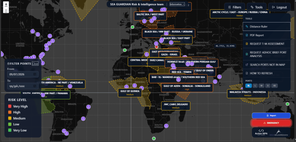
The system offers an advanced data, control, and reporting environment (not just a digital guard), providing near-real-time maritime intelligence, risk analysis, and secure communication. DACOR is not only an interactive map a user sees upon log-in, but also a series of capabilities (including guarding, warning, assessing, consulting, and even scouting), together with reports, updates, and daily key events processed on a continuous 24/7 basis. A user can get an overview of global incidents, receive near-real-time threat assessments, and access structured data on maritime security, operations, and navigation issues. It allows the user to prepare reports fast and communicate securely, providing confidentiality to support personalized client access. The DACOR system supports the decision-making process at every level, including strategic (management), operational (office operators), and tactical (Masters & Security Team Leaders).
John Pavlopoulos
President of the SEA GUARDIAN Board
Detailed Presentation
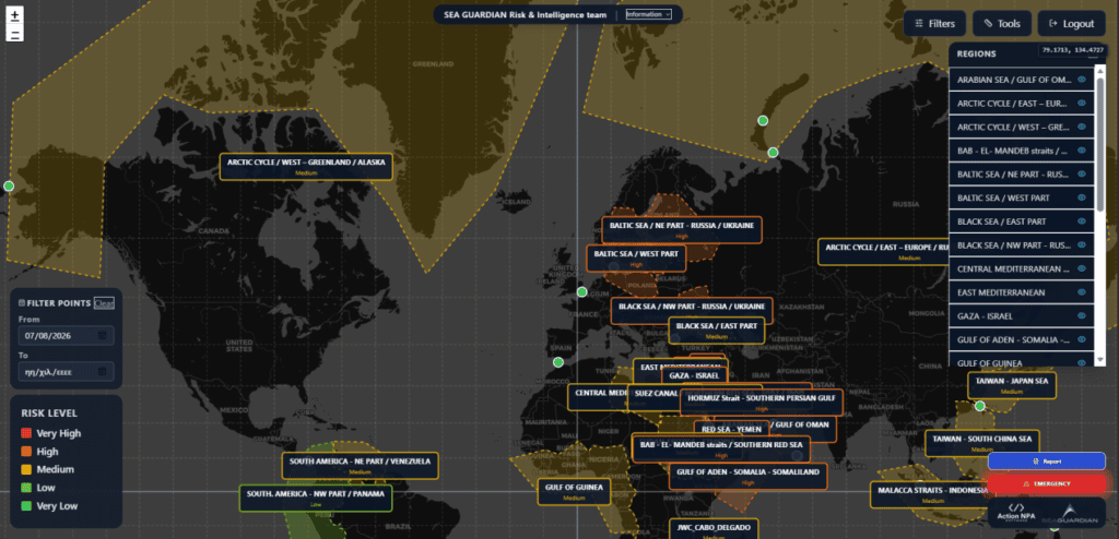
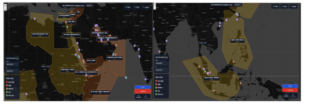
The system monitors and assesses permanently 25 regions around the globe, chosen according to their importance for international shipping, the risks they are exposed to, and the traffic performance of a strait. Through the menu filters the user can obtain/hide the maritime region he would like to examine:
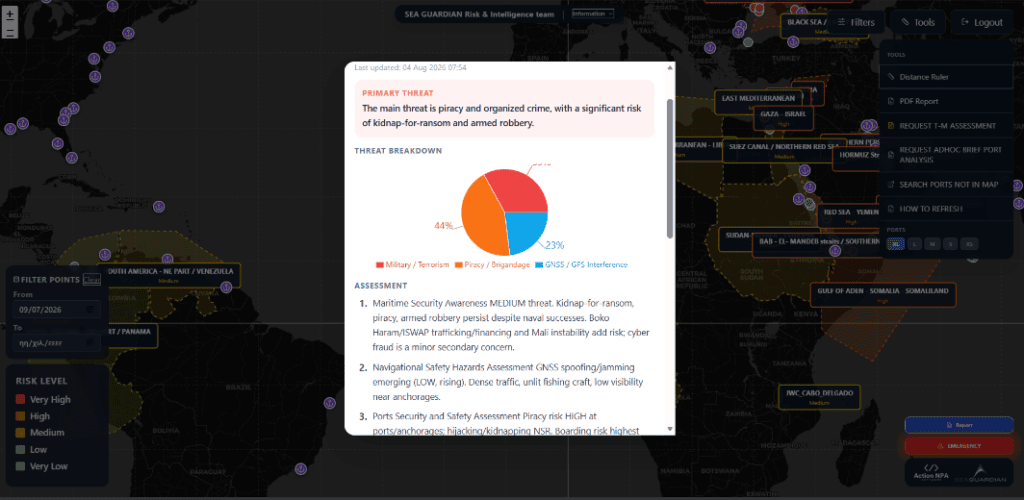
Each region projects different threats and risks in the maritime domain relevant to the geopolitical, geo–economic, or social situation on land. Those threats and risks are depicted in a breakdown chart along with a brief assessment and consultancy:
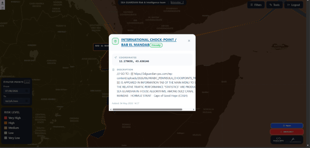
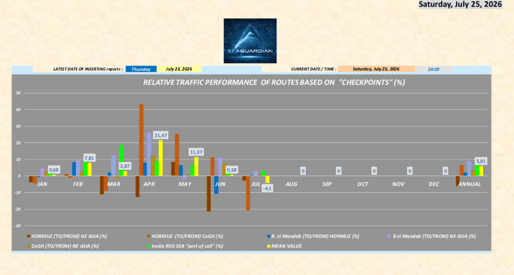
Twelve international choke-points around the globe are constantly monitored, while SEA GUARDIAN’S INTERNAL app and algorithms process data to produce relative traffic performance of each strait, in order to assess fluctuations as a factor for decision-making.
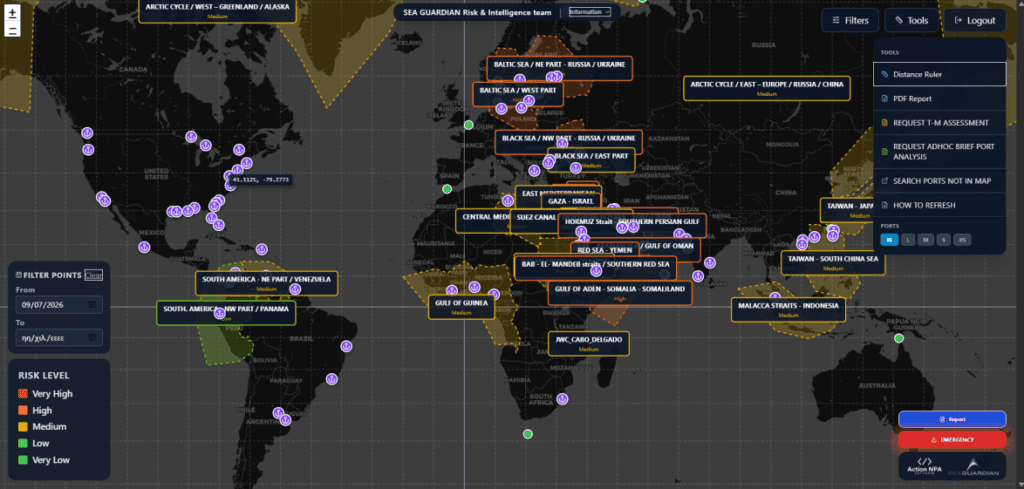
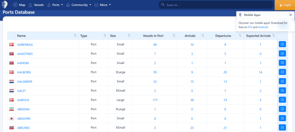
The near-real-time activity is monitored with the capability to obtain last month’s performance, see departures and arrivals, and see vessels in port, including the characteristics of each port. The following image shows only the XL (EXTRA LARGE) ports, while the user can obtain other sized ports (L-M-S-XS) loaded in the system. Searching for other ports via the “Tools” menu is possible, as shown in the next image:
Maritime security breaches worldwide are loaded on a 24/7 basis from numerous sources to build the strategic, operational, and tactical maritime picture. Additional details are drawn from UKMTO, IMB/ICC, MDAT-GOG, MSCIO and other open sources, adding extra details for each incident. By default, once the user activates DACOR, the ongoing month’s incidents are presented, and the user can also select any desired period to project previous cases
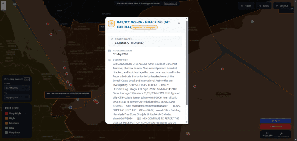
The details of each incident can be obtained by opening the relevant folder, while the user can also see the last known position of the vessel affected:
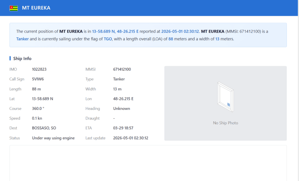
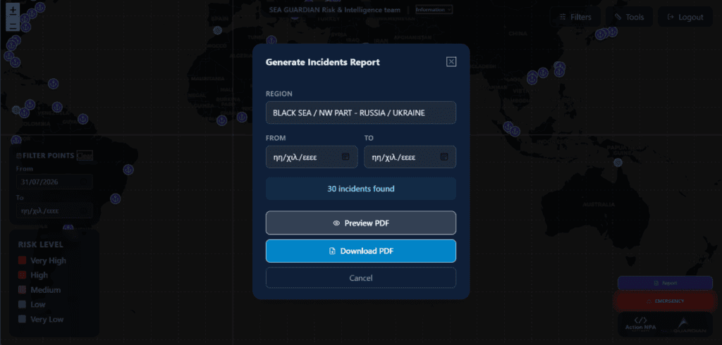
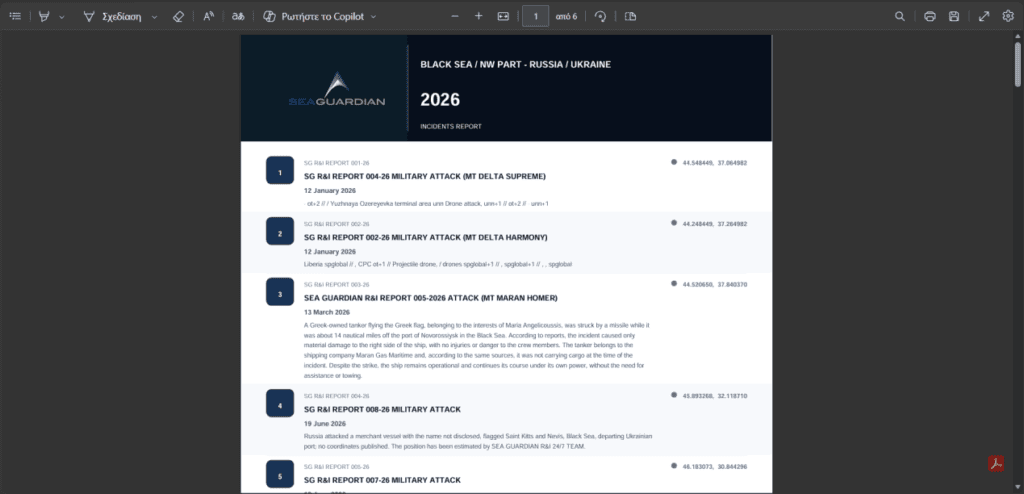
As DACOR is a multi-layered data, control and reporting system, the user can auto-call the generation of a report for incidents by region:
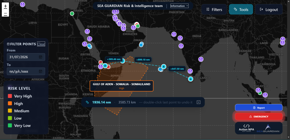
Once the user wishes to plan a voyage, he/she can also measure distances with the “distance ruler” contained in the menu of “Tools”:
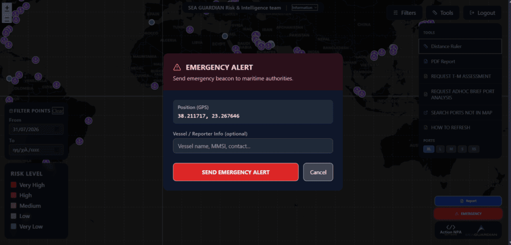
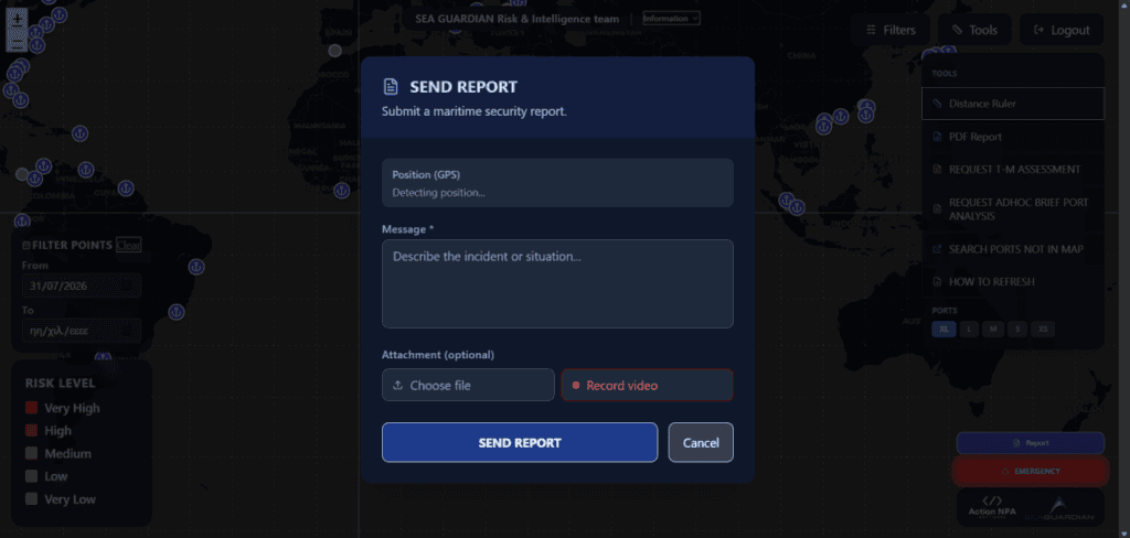
A “close reporting system” is provided exclusively for the “user’s eyes only”, administered by SEA GUARDIAN or the shipping company management. The menus for emergency alerts and reports are depicted in the next two images:
If an incident occurs or there is a brief change in the assessment/consultancy for a given situation, the system auto-generates notifications, by sending e-mails to the users, while providing notification on the map profile when opening:
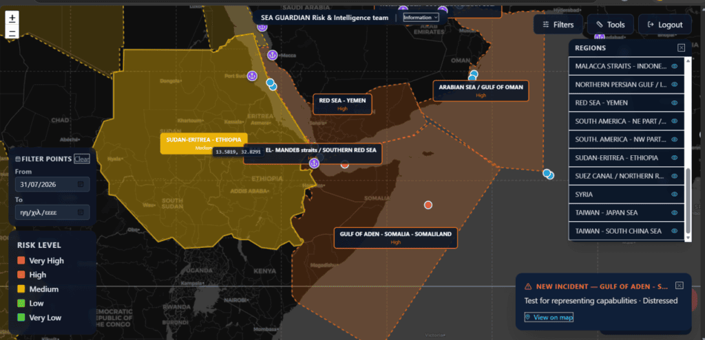
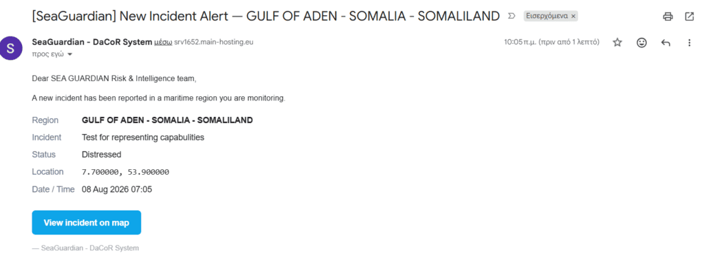
The user can also go directly to the incident, once it has been inserted:
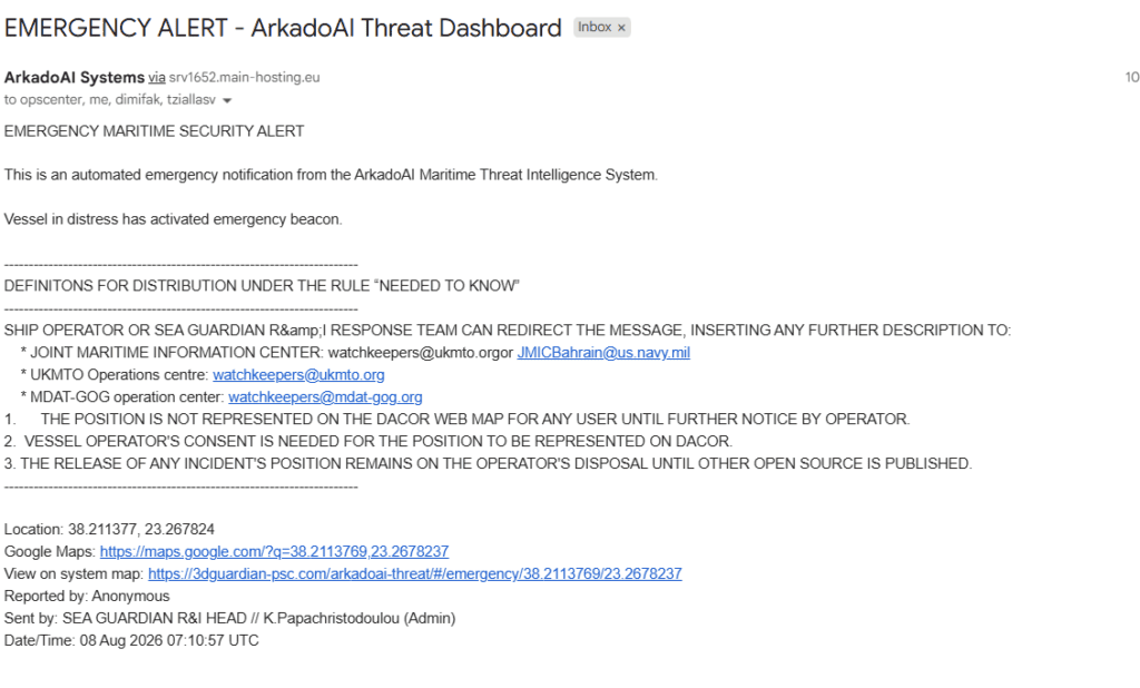
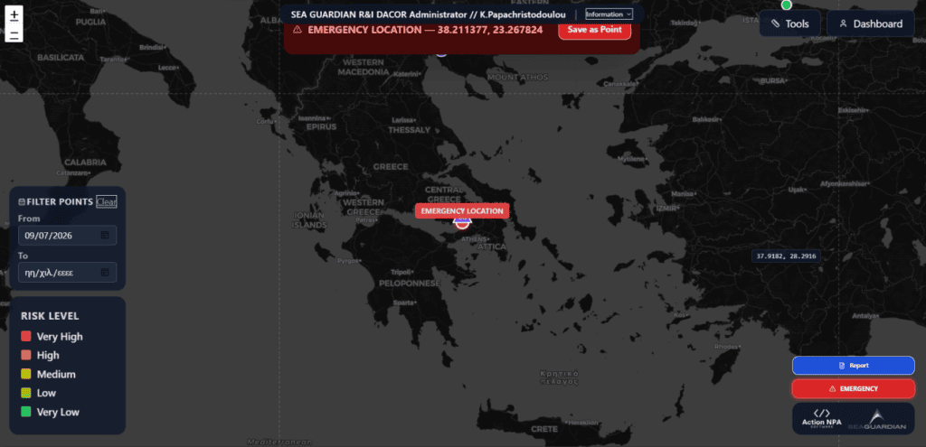
Choosing to obtain the emergency report on the map, the relevant location is depicted:
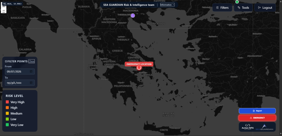
Unless the emergency position is being released by the shipping company of a vessel, only SEA GUARDIAN admin (Head of Intelligence), editor (OpsCenter), and editor/ext (Maritime company’s operations or security) possess this information.
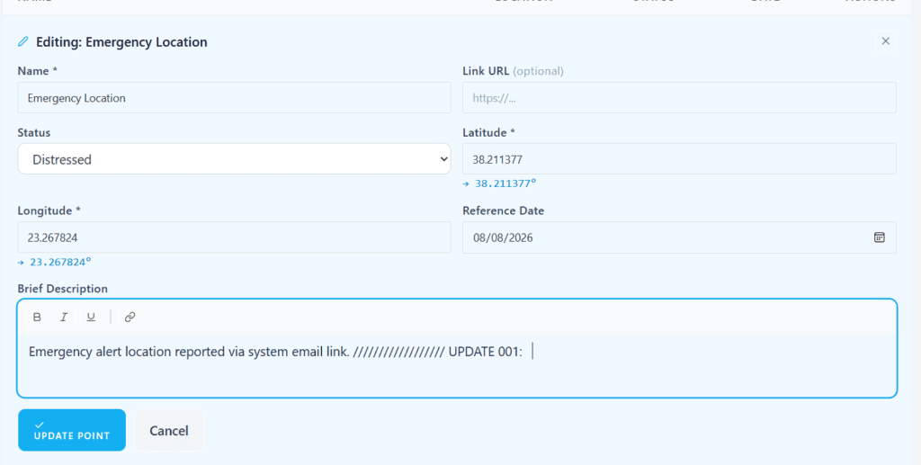
After assigning the emergency alert to a fixed location, a notification is sent, and the incident can be updated with further details:
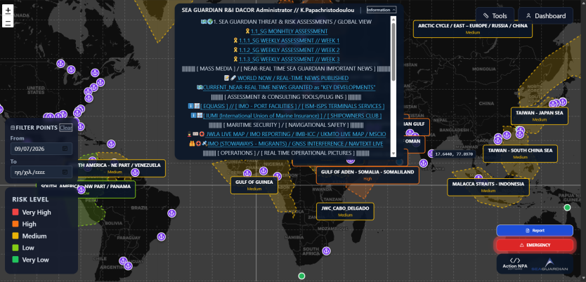
Once a user opens the DACOR system, he/she has access to multiple plug-in SEA GUARDIAN resources, once “Scouting” has chosen to permanently populate the system with the new information and employ all of its supporting tools:
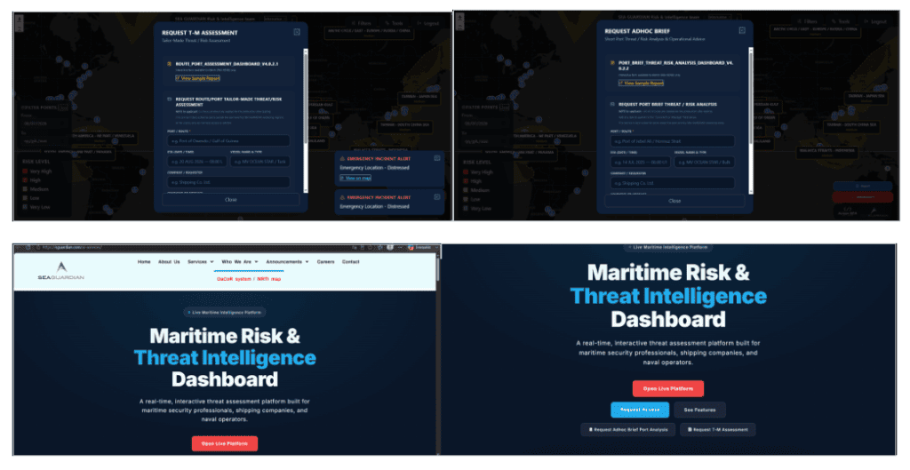
As DACOR accumulates a large number of information reports and evaluations from maritime experts, enhanced by AI supportive tools and internal apps/algorithms for the production of assessed information (Intelligence), it is capable of supporting a user’s request for a “tailor-made” assessment: